Military Sinkhole; Mogollon Rim, September 2, 2021 GPS Map

Clara has only done this hike in the counterclockwise direction. I’ve done it many times in both directions. This was the first hike I did with the Motorola Hiking Club, on July 3, 1999.

This time I fizzled out at the Military Sinkhole. Gave my car key to Clara and had her bring my car. Then we ate lunch at Macky’s Grill in Payson, and Clara drove us home.

We drove through rain from Usery Pass Trailhead to the Beeline Highway. It was foggy but dry when we started the hike. The trail was wet from rain the day before, but it didn’t rain while we were hiking. Lots of mosquitoes.


fog
It was foggy but not raining when we started.
fungus fungus
Mushrooms. We dare not find out whether they are edible.
weeds
Rushes.  Where’s the scouring?
view
They built the Communications Tower, and the Rim Lakes Vista Trail used to go right past it. Then they rerouted the trail.
trail
The trail takes a dip through a wash.
lizard
Clara caught a horned toad, then set it free.
wood
Let’s do the Twist.
log
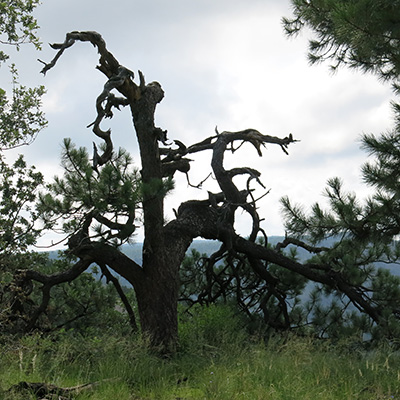
I was once standing tall, you see.
wood
He did it.
view
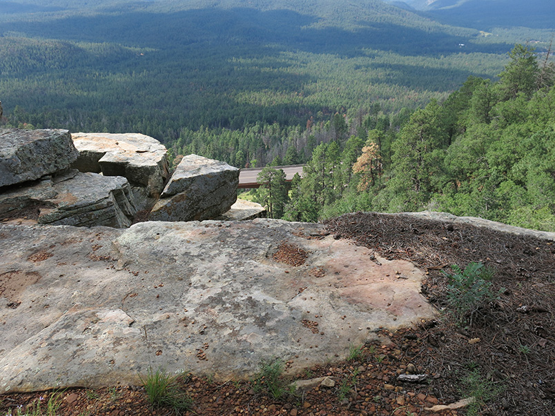
You can’t see any lakes from the Rim Lakes Vista Trail, but how’s this view?
rock
Come sit a while.
bridge
Who needs bridge supports?
bridge
You do.
view
We’re on the very edge of the Mogollon Rim.
Clara
Clara inspects the Military Sinkhole.
white blue
red yellow
blue white
blue mixed
yellow pink
yellow blue
Late summer wildflowers brighten our way.

  More Hike Pictures updated September 3, 2021